As far as I can remember from my history 101 class, there are two sites that stand out in the fight against the Japanese Imperial Army during the Second World War. One is the island of Corregidor, while the other is Mount Samat. It’s not just an ordinary mountain with a diverse ecosystem, but a living reminder of Filipinos’ fortitude and bravery.
At approximately 73,665 hectares, the national shrine was completed in 1970 to commemorate the fallen Filipino and American troops who fearlessly fought and died during World War II. According to our tour guide from Veterans Memorial and Historical Division, Bong Mamuad Sr., Mount Samat served as the last bastion of the Allied forces. Going to the Shrine of Valor would require you to use your navigation apps. Uphill climb and steep roads await, so we highly recommend everyone to travel with a capable vehicle.

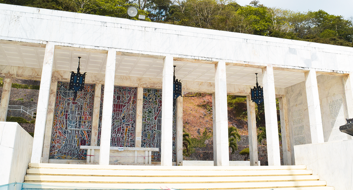
The shrine features two iconic architectural sites—the Colonnade and the towering Memorial Cross—both of which were designed by Arch. Lorenzo Del Castillo. At the foot of the shrine are three series of steps that lead to a flagpole that holds the Philippine flag and a marble-clad structure known as Colonnade, with an esplanade, altar, and underground museum. By the entrance at the far left of the building, you can see the last
155 mm Towed Howitzer that is currently undergoing restoration.
On its walls are 19 sculptural marble reliefs depicting the war by Napoleon Abueva along with the 18 bronze insignia and flagpoles of USAFFE divisions. Behind the altar lie the three stained glass murals of Malakas, Maganda, and Mahinhin designed by Cenon Rivera. Inside, four large bronze chandeliers hang from the ceiling, and inscribed on the two lateral walls are significant events from the historic Battle of Bataan.
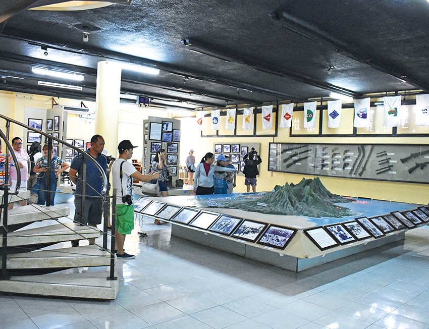
We went into the underground World War II museum which is home to items from the war, such as old uniforms, weapons, and other military equipment. Hanging from the walls are troop flags that participated in the battles here. For history buffs, there’s also General Douglas MacArthur’s strategic map of the whole of Bataan.
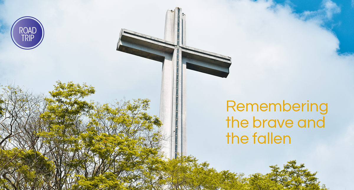
Atop the mountain is a breathtaking view, leaving visitors in awe as they witness the rising and setting of the sun while overlooking the whole Bataan peninsula. You may opt to walk the 14-flight, 448-step footpath, or drive your car on the way up to reach the memorial cross. Standing an imposing 360 feet, it is the second tallest cross in Asia and is 555 m above sea level.
The exterior of the cross is finished with chipped granolithic marble. On its base, you can see sculptures depicting significant historical events. The Nabiag na Bato, made by Napoleon Abueva, features some of our local heroes like Jose Rizal, General Antonio Luna, and Lapu-Lapu. A gigantic bronze door melted from artillery shells greets guests as they enter. Embossed with a large “DK,” that stands for Dambana ng Kagitingan made by Abueva, the door also has carvings that illustrates events from WWII, crafted by Maximo Vicente.
With a total length of 30 meters, the crossbeam serves as the viewing gallery. To go up, guests would need to use the lift and alight on the 27th floor. Facing north, you can see the province of Pampanga, while to the West, visitors can see the mountain range of Zambales. The eastern and southern parts of the cross offers the view of Manila and Corregidor island. The guards of the memorial cross regulate foot traffic, limiting people to a stay of 10 minutes inside the observation deck.
Operating Hours:
8 AM to 5 PM
Monday to Sunday
Words by Jewel Sta. Ana | Photos by Jezeil Romero
Also published in GADGETS MAGAZINE April


